mNo edit summary |
m (→Media) |
||
| (22 intermediate revisions by 2 users not shown) | |||
| Line 17: | Line 17: | ||
== Workshop == | == Workshop == | ||
* [[/Home is Where you get a Signal|Home is Where you get a Signal]] A two hour sketch output by the “Büro für Unabwägbarkeiten” and Gabriel Menotti | * [[/Home is Where you get a Signal|Home is Where you get a Signal]] A two hour sketch output by the “Büro für Unabwägbarkeiten” and Gabriel Menotti | ||
* [[ | * [[Mapping]] micro crash-course on [[GPS]]-cartography by Max Neupert. Get the [[File:Excursion to Dortmund TV Tower.gpx]] to import this in Google Earth or [http://www.openstreetmap.org/user/panoramedia/traces/779674 view in Open Street Map]. | ||
* [[How can I Transmit via Satellite?]] - some thoughts on a question that appeared during the workshop | * [[How can I Transmit via Satellite?]] - some thoughts on a question that appeared during the workshop | ||
* [[How to spot Iridium satellites with bare eyes]] - internet based weather and satellite prediction combined with three dimensional orientation in physical space | * [[How to spot Iridium satellites with bare eyes]] - internet based weather and satellite prediction combined with three dimensional orientation in physical space | ||
* [[Traces of satellite-use in the city]] - a walk through Dortmund Nordstadt. Elena Marcevska and Lena Brüggemann | * [[Traces of satellite-use in the city]] - a walk through Dortmund Nordstadt. Elena Marcevska and Lena Brüggemann | ||
* [[Satellites and Aviation - sensing around Dortmund Airport]] - Ursel Quint - Frank Hoppe | |||
== Satellite information == | == Satellite information == | ||
| Line 27: | Line 27: | ||
* [[Space linklist]] a list of space related links, artists, astronomy and satellite tracking | * [[Space linklist]] a list of space related links, artists, astronomy and satellite tracking | ||
* [[Weather]] resources, forecasts, cloud satellite images and rain maps, not only for astronomy. | * [[Weather]] resources, forecasts, cloud satellite images and rain maps, not only for astronomy. | ||
* [[ | * [[GPS]] mapping websites, cartography and GPS artworks | ||
* [[Suppliers#Electric and electronic parts]] consult this page if you want to buy electronics like GPS receivers/loggers | * [[Suppliers#Electric and electronic parts]] consult this page if you want to buy electronics like GPS receivers/loggers | ||
* [http://www.lyngsat.com lyngsat.com] great resource about all satellites and their footprints | * [http://www.lyngsat.com lyngsat.com] great resource about all satellites and their footprints | ||
| Line 33: | Line 33: | ||
* [http://www.flickr.com/photos/michaelpaukner/4314987544/sizes/o/in/photostream Michael Paulkner] Infographic: satellites and their owners | * [http://www.flickr.com/photos/michaelpaukner/4314987544/sizes/o/in/photostream Michael Paulkner] Infographic: satellites and their owners | ||
* [http://www.vizworld.com/tag/satellite vizworld] collection of graphic visualizations about satellite technology | * [http://www.vizworld.com/tag/satellite vizworld] collection of graphic visualizations about satellite technology | ||
* [http://www.thisisrealart.com/#Astra/Documentary%20films/196/print/0 Satellites: A user manual] Beautiful infomercials by agency ThisIsRealArt | * [http://www.thisisrealart.com/#Astra/Documentary%20films/196/print/0 Satellites: A user manual] Beautiful infomercials by agency ThisIsRealArt for Astra-SES. | ||
*[http://www.satsignal.net/ www.satsignal.net] Huge collection of information about satellites and signals. Codes, decoding, software, mapping. Some of the software is commercial. | *[http://www.satsignal.net/ www.satsignal.net] Huge collection of information about satellites and signals. Codes, decoding, software, mapping. Some of the software is commercial. | ||
| Line 45: | Line 45: | ||
=== Satellite dishes === | === Satellite dishes === | ||
[[File:Satellite dish Weimar.jpg|thumb|Satellite dish in Weimar]] | |||
* [http://www.youtube.com/watch?v=GXKo0ienGgg Satellite free-to-air DIY kit] | * [http://www.youtube.com/watch?v=GXKo0ienGgg Satellite free-to-air DIY kit] | ||
* [http://www.youtube.com/watch?v=tnY7UVyaFiQ How to Reverse-Engineer a Satellite TV Smart Card] | * [http://www.youtube.com/watch?v=tnY7UVyaFiQ How to Reverse-Engineer a Satellite TV Smart Card] | ||
| Line 60: | Line 61: | ||
* [http://www.jpaerospace.com/away5.html Away 5] – Advanced Balloon Platform | * [http://www.jpaerospace.com/away5.html Away 5] – Advanced Balloon Platform | ||
== | == Artworks and artists == | ||
See [[Space Art]]. | See [[Space Art]] for a list of artists who deal with satellites and/or outer space in their practice. A compilation of artists and literature about locative artworks is filed as [[GPS]]. | ||
== Books, readers == | == Books, readers == | ||
| Line 75: | Line 76: | ||
* Virilio, Paul: [http://www.scribd.com/doc/20343380/virilio-1992-big-optics-on-justifying-the-hypothetical-nature-of-art-and-the-non-identicality-within-the-object-world Big Optics] (scribd link) | * Virilio, Paul: [http://www.scribd.com/doc/20343380/virilio-1992-big-optics-on-justifying-the-hypothetical-nature-of-art-and-the-non-identicality-within-the-object-world Big Optics] (scribd link) | ||
* Weibel, Peter (publisher): Ocean Earth: 1980 bis heute ISBN 3927789720 | * Weibel, Peter (publisher): Ocean Earth: 1980 bis heute ISBN 3927789720 | ||
== Media == | |||
<gallery> | |||
File:SBF Workshop04.jpg|Lecture Francis | |||
File:SBF Workshop02.jpg|Presentation Büro | |||
File:SBF Workshop03.jpg|David | |||
File:SBF Workshop14.jpg|Lecture Lisa | |||
File:SBF Workshop05.jpg|Concrete in daylight | |||
File:SBF Workshop15.jpg|Concrete at sunset | |||
File:SBF Workshop16.jpg|Essen in Dortmund | |||
File:SBF Workshop10.jpg|Advertising | |||
File:SBF Workshop09.jpg|GPS logger | |||
File:SBF Workshop06.jpg|Florian Tower | |||
File:SBF Workshop01.jpg|View from tower | |||
File:SBF Workshop08.jpg|View from tower | |||
File:SBF Workshop07.jpg|Phoenixhalle from TV-tower | |||
File:SBF Workshop12.jpg|Sniffing sounds | |||
File:SBF Workshop11.jpg|View from tower | |||
File:SBF Workshop17.jpg|View from tower | |||
</gallery> | |||
[[File:SBF Workshop13.jpg|570px]] | |||
* More [http://picasaweb.google.com/gabriel.menotti/SatelliteBorderFootprint pictures] of the walk to the Florian tower and of the presentations by Gabriel | |||
[[Category:Linklist]] | [[Category:Linklist]] | ||
[[Category:GPS]] | [[Category:GPS]] | ||
[[Category:Satellite]] | |||
Latest revision as of 09:59, 14 October 2010
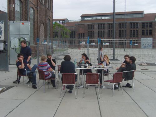
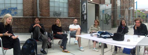
Space to share information, links etc. for the Satellite/Border/Footprint Workshop by Lisa Parks at the HMKV, organized by Francis Hunger
Participants
- Lena Brüggemann (D)
- Büro für Unabwägbarkeiten (D) David Hahlbrock, Franziska Windisch, Anselm Bauer
- Francis Hunger, (D)
- Frank Hoppe (D)
- Elena Marcevska (UK/MAC)
- Gabriel Menotti (UK/BR)
- Max Neupert (D)
- Lisa Parks, (US) University of California, Santa Barbara
- SnowKrash (D) Ursel Quint & Barry L. Roshto
- Tatjana Vukelic (SER)
Workshop
- Home is Where you get a Signal A two hour sketch output by the “Büro für Unabwägbarkeiten” and Gabriel Menotti
- Mapping micro crash-course on GPS-cartography by Max Neupert. Get the File:Excursion to Dortmund TV Tower.gpx to import this in Google Earth or view in Open Street Map.
- How can I Transmit via Satellite? - some thoughts on a question that appeared during the workshop
- How to spot Iridium satellites with bare eyes - internet based weather and satellite prediction combined with three dimensional orientation in physical space
- Traces of satellite-use in the city - a walk through Dortmund Nordstadt. Elena Marcevska and Lena Brüggemann
- Satellites and Aviation - sensing around Dortmund Airport - Ursel Quint - Frank Hoppe
Satellite information
- Space Is The Place A class by Max Neupert in the winter semester 2009
- Space linklist a list of space related links, artists, astronomy and satellite tracking
- Weather resources, forecasts, cloud satellite images and rain maps, not only for astronomy.
- GPS mapping websites, cartography and GPS artworks
- Suppliers#Electric and electronic parts consult this page if you want to buy electronics like GPS receivers/loggers
- lyngsat.com great resource about all satellites and their footprints
- satbeams.com
- Michael Paulkner Infographic: satellites and their owners
- vizworld collection of graphic visualizations about satellite technology
- Satellites: A user manual Beautiful infomercials by agency ThisIsRealArt for Astra-SES.
- www.satsignal.net Huge collection of information about satellites and signals. Codes, decoding, software, mapping. Some of the software is commercial.
Representation from orbital perspective
- Powers of Ten, Charles and Ray Eames wikipedia:Powers of ten. Other earth Zooms.
- GMU:Works#Bernhard Hopfengärtner: HELLO WORLD!
- Dead pixel in Google Earth, Helmut Smits
- wikipedia:Leylines, wikipedia:Nazca lines wikipedia:crop circles
- www.diydrones.com Resources for DIY Drones (Autonomous Robotic Vehicles) which can carry scan devices (e.g. cameras)
- Grassroots Mapping, forms of not-so-remote sensing and low-tech mapmaking
Satellite dishes
- Satellite free-to-air DIY kit
- How to Reverse-Engineer a Satellite TV Smart Card
- The Max Headroom Incident (don't know where this should go)
- The Itty Bitty Radio Telescope a DIY Radio Telescope made of a satellite dish
Satellite tracking
See Satellite tracking.
Balloon Information
- 1337arts.com Project Ikarus – low cost near space remote technology
- University of Wyoming’s balloon trajectory website Predict your balloon flight in google earth related to your geo-coordinates
- telegraph.co.uk Article in the online edition of newspaper The Telegraph (UK): Teens capture images of space with 56 pounds camera and a balloon
- Hobbyspace.com Near Space exploring with balloons on hobbyspace.com – a resource for amateur space action
- Away 5 – Advanced Balloon Platform
Artworks and artists
See Space Art for a list of artists who deal with satellites and/or outer space in their practice. A compilation of artists and literature about locative artworks is filed as GPS.
Books, readers
- Material listing
- von Borries, Friedrich; Böttger, Matthias; Heilmeyer, Florian: TV Towers – 8,559 Meters Politics and Architecture ISBN 3868590242
- Günther, Ingo: REPUBLIK.COM ISBN 3893229485
- McCray, W. Patrick: Keep Watching the Skies, ISBN 0691128545
- Paglen, Trevor: Blank Spots On The Map – The Dark Goegraphy Of The Pentagon's Secret World ISBN 9780525951018
- Paglen, Trevor: I Could Tell You But Then You Would Have To Be Destroyed By Me - Emblems From The Pentagon's Black World ISBN 9781933633329
- Parks, Lisa: Cultures in Orbit – Satellites and the Televisual ISBN 978-0822334972
- Redfield, Peter: Space in the Tropics: From Convicts to Rockets in French Guiana ISBN 0520219856
- Virilio, Paul: Open Sky, Verso, 1997, ISBN 1859841813
- Virilio, Paul: Big Optics (scribd link)
- Weibel, Peter (publisher): Ocean Earth: 1980 bis heute ISBN 3927789720
Media
- More pictures of the walk to the Florian tower and of the presentations by Gabriel


