(updated to 2015) |
|||
| Line 10: | Line 10: | ||
== Tuesday, May 11 2015 == | == Tuesday, May 11 2015 == | ||
[[File:BuchenwaldTour4.png|right | [[File:BuchenwaldTour4.png|right|link=https://www.komoot.de/tour/4531252]] | ||
'''Meeting Point 1:''' Wielandplatz Weimar | '''Meeting Point 1:''' Wielandplatz Weimar | ||
Revision as of 12:29, 11 May 2015
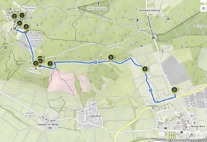
Weimar Buchenwald, Ettersberg, Glockenturm, Straße der Nationen
- https://www.komoot.de/tour/4531252
- http://www.buchenwald.de/132
- Audio Guide iOS(DE), iOS(EN) 2,99 €
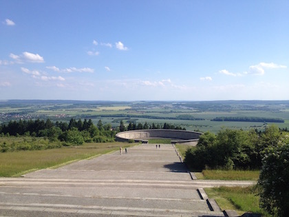
We will have a couple of minutes for everyone to explore the Gedenkstätte individually. There is an official Audio-Guide app in the iOS AppStore (see above), Android users may rent an iPod at the entrance (more than 3,- € IIRC). Then we'll take a look at the Glockenturm monument and the »Straße der Nationen« south of the camp. We will cross a former military area waling down a sunny hill towards the next bus station or the Hauptbahnhof.
Tuesday, May 11 2015
Meeting Point 1: Wielandplatz Weimar
- Departure: Bus #6 to Buchenwald, 15:40 Uhr
Meeting Point 2: Goetheplatz Weimar
- Departure: Bus #6 to Buchenwald, 15:45 Uhr
Meeting Point 3: Gedenkstätte Buchenwald
- Arrival: Bus #6, 16:02 Uhr
Tour: https://www.komoot.de/tour/4531252
- KZ-Gedenkstätte Buchenwald
- Bahnhof Buchenwald
- Glockenturm mit Figurengruppe
- Mahnmal Buchenwald
- Straße der Nationen
- Ehem. Militärisches Sperrgebiet Südhang Ettersberg
Length/Duration:
- ~8 km, with stops and individual time ~3 to 4 hrs
Back to Weimar:
- Bus #6, Am Herrenrödchen, 18.34, 19.21, 19.48 (last bus, only to Hauptbahnhof)
Things to pack:
- A bottle of water
- Food if you're hungry (AFAIR there is no Biergarten)
- Appropriate footwear
Weather:
- 26 to 28°C, sun and cloud mix: Wetter Weimar

