No edit summary |
m (→Media) |
||
| (102 intermediate revisions by 9 users not shown) | |||
| Line 1: | Line 1: | ||
Space to share information, links etc. | Space to share information, links etc. for the [http://www.hmkv.de/satelliteborderfootprint/ Satellite/Border/Footprint Workshop by Lisa Parks] at the HMKV, organized by Francis Hunger | ||
* [[GMU:Space Is The Place]] A class by [[Max Neupert]] in the winter semester 2009 | [[File:Satelliteborderfootprintworkshop.jpg|500px]]<br /> | ||
* [[Space | |||
== Participants == | |||
* [[/Lena Brüggemann/]] (D) | |||
* [[/Büro für Unabwägbarkeiten/]] (D) [[/David Hahlbrock/]], [[/Franziska Windisch/]], [[/Anselm Bauer/]] | |||
* [[/Francis Hunger/]], (D) | |||
* [[/Frank Hoppe/]] (D) | |||
* [[/Elena Marcevska/]] (UK/MAC) | |||
* [[/Gabriel Menotti/]] (UK/BR) | |||
* [[/Max Neupert/]] (D) | |||
* [[/Lisa Parks/]], (US) University of California, Santa Barbara | |||
* [[/SnowKrash/]] (D) [[/Ursel Quint/]] & [[/Barry L. Roshto/]] | |||
* [[/Tatjana Vukelic/]] (SER) | |||
== Workshop == | |||
* [[/Home is Where you get a Signal|Home is Where you get a Signal]] A two hour sketch output by the “Büro für Unabwägbarkeiten” and Gabriel Menotti | |||
* [[Mapping]] micro crash-course on [[GPS]]-cartography by Max Neupert. Get the [[File:Excursion to Dortmund TV Tower.gpx]] to import this in Google Earth or [http://www.openstreetmap.org/user/panoramedia/traces/779674 view in Open Street Map]. | |||
* [[How can I Transmit via Satellite?]] - some thoughts on a question that appeared during the workshop | |||
* [[How to spot Iridium satellites with bare eyes]] - internet based weather and satellite prediction combined with three dimensional orientation in physical space | |||
* [[Traces of satellite-use in the city]] - a walk through Dortmund Nordstadt. Elena Marcevska and Lena Brüggemann | |||
* [[Satellites and Aviation - sensing around Dortmund Airport]] - Ursel Quint - Frank Hoppe | |||
== Satellite information == | |||
* [[GMU:Space Is The Place|Space Is The Place]] A class by [[Max Neupert]] in the winter semester 2009 | |||
* [[Space linklist]] a list of space related links, artists, astronomy and satellite tracking | |||
* [[Weather]] resources, forecasts, cloud satellite images and rain maps, not only for astronomy. | * [[Weather]] resources, forecasts, cloud satellite images and rain maps, not only for astronomy. | ||
* [[ | * [[GPS]] mapping websites, cartography and GPS artworks | ||
* [[Suppliers#Electric and electronic parts]] consult this page if you want to buy electronics like GPS receivers/loggers | |||
* [http://www.lyngsat.com lyngsat.com] great resource about all satellites and their footprints | * [http://www.lyngsat.com lyngsat.com] great resource about all satellites and their footprints | ||
* [http://www.satbeams.com/footprints satbeams.com] | * [http://www.satbeams.com/footprints satbeams.com] | ||
* [http://www.flickr.com/photos/michaelpaukner/4314987544/sizes/o/in/photostream Michael Paulkner] Infographic: satellites and their owners | * [http://www.flickr.com/photos/michaelpaukner/4314987544/sizes/o/in/photostream Michael Paulkner] Infographic: satellites and their owners | ||
* [http://www.vizworld.com/tag/satellite vizworld] collection of graphic visualizations about satellite technology | * [http://www.vizworld.com/tag/satellite vizworld] collection of graphic visualizations about satellite technology | ||
* [http://www.thisisrealart.com/#Astra/Documentary%20films/196/print/0 Satellites: A user manual] Beautiful infomercials by agency ThisIsRealArt for Astra-SES. | |||
*[http://www.satsignal.net/ www.satsignal.net] Huge collection of information about satellites and signals. Codes, decoding, software, mapping. Some of the software is commercial. | |||
=== Representation from orbital perspective === | |||
* [http://www.youtube.com/watch?v=GjrOBWk-R4A Powers of Ten], Charles and Ray Eames [[wikipedia:Powers of ten]]. Other earth [[Zoom]]s. | |||
* [[GMU:Works#Bernhard Hopfengärtner: HELLO WORLD!]] | |||
* [http://www.todayandtomorrow.net/2009/03/27/dead-pixel-in-google-earth/ Dead pixel in Google Earth], Helmut Smits | |||
* [[wikipedia:Leyline]]s, [[wikipedia:Nazca line]]s [[wikipedia:crop circle]]s | |||
*[http://diydrones.com www.diydrones.com] Resources for DIY Drones (Autonomous Robotic Vehicles) which can carry scan devices (e.g. cameras) | |||
*[http://grassrootsmapping.org/ Grassroots Mapping], forms of not-so-remote sensing and low-tech mapmaking | |||
=== Satellite dishes === | |||
[[File:Satellite dish Weimar.jpg|thumb|Satellite dish in Weimar]] | |||
* [http://www.youtube.com/watch?v=GXKo0ienGgg Satellite free-to-air DIY kit] | |||
* [http://www.youtube.com/watch?v=tnY7UVyaFiQ How to Reverse-Engineer a Satellite TV Smart Card] | |||
* [http://www.youtube.com/watch?v=tWdgAMYjYSs The Max Headroom Incident] (don't know where this should go) | |||
* [http://www.aoc.nrao.edu/epo/teachers/ittybitty/procedure.html The Itty Bitty Radio Telescope] a DIY Radio Telescope made of a satellite dish | |||
=== Satellite tracking === | |||
See [[Satellite tracking]]. | |||
== | === Balloon Information === | ||
*[ | * [http://space.1337arts.com/hardware 1337arts.com] Project Ikarus – low cost near space remote technology | ||
*[ | * [http://weather.uwyo.edu/polar/balloon_traj.html University of Wyoming’s balloon trajectory website] Predict your balloon flight in google earth related to your geo-coordinates | ||
*[ | * [http://www.telegraph.co.uk/news/newstopics/howaboutthat/5005022/Teens-capture-images-of-space-with-56-camera-and-balloon.html telegraph.co.uk] Article in the online edition of newspaper The Telegraph (UK): ''Teens capture images of space with 56 pounds camera and a balloon'' | ||
* [http://www.hobbyspace.com/NearSpace/index.html#Balloons Hobbyspace.com] Near Space exploring with balloons on hobbyspace.com – a resource for amateur space action | |||
* [http://www.jpaerospace.com/away5.html Away 5] – Advanced Balloon Platform | |||
*[ | |||
*[ | |||
== | == Artworks and artists == | ||
See [[Space Art]] for a list of artists who deal with satellites and/or outer space in their practice. A compilation of artists and literature about locative artworks is filed as [[GPS]]. | |||
== Books, | == Books, readers == | ||
* [http://www.hmkv.de/satelliteborderfootprint/material.htm Material listing] | * [http://www.hmkv.de/satelliteborderfootprint/material.htm Material listing] | ||
* | * von Borries, Friedrich; Böttger, Matthias; Heilmeyer, Florian: TV Towers – 8,559 Meters Politics and Architecture ISBN 3868590242 | ||
* Günther, Ingo: REPUBLIK.COM ISBN 3893229485 | |||
* McCray, W. Patrick: Keep Watching the Skies, ISBN 0691128545 | * McCray, W. Patrick: Keep Watching the Skies, ISBN 0691128545 | ||
* Paglen, Trevor: Blank Spots On The Map – The Dark Goegraphy Of The Pentagon's Secret World ISBN 9780525951018 | |||
* Paglen, Trevor: I Could Tell You But Then You Would Have To Be Destroyed By Me - Emblems From The Pentagon's Black World ISBN 9781933633329 | |||
* Parks, Lisa: Cultures in Orbit – Satellites and the Televisual ISBN 978-0822334972 | |||
* Redfield, Peter: Space in the Tropics: From Convicts to Rockets in French Guiana ISBN 0520219856 | * Redfield, Peter: Space in the Tropics: From Convicts to Rockets in French Guiana ISBN 0520219856 | ||
* Weibel, Peter (publisher): Ocean Earth : 1980 bis heute ISBN 3927789720 | * Virilio, Paul: [http://books.google.com/books?id=OF_cPrltMmsC&printsec=frontcover&dq=%22open+sky%22&hl=en&ei=kkJXTKbqKI2K4QaA95mnBQ&sa=X&oi=book_result&ct=result&resnum=1&ved=0CCkQ6AEwAA#v=onepage&q&f=false Open Sky], Verso, 1997, ISBN 1859841813 | ||
* Virilio, Paul: [http://www.scribd.com/doc/20343380/virilio-1992-big-optics-on-justifying-the-hypothetical-nature-of-art-and-the-non-identicality-within-the-object-world Big Optics] (scribd link) | |||
* Weibel, Peter (publisher): Ocean Earth: 1980 bis heute ISBN 3927789720 | |||
== Media == | |||
<gallery> | |||
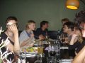
File:SBF Workshop04.jpg|Lecture Francis | |||
File:SBF Workshop02.jpg|Presentation Büro | |||
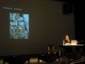
File:SBF Workshop03.jpg|David | |||
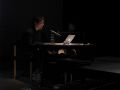
File:SBF Workshop14.jpg|Lecture Lisa | |||
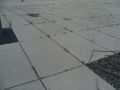
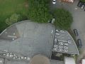
File:SBF Workshop05.jpg|Concrete in daylight | |||
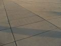
File:SBF Workshop15.jpg|Concrete at sunset | |||
File:SBF Workshop16.jpg|Essen in Dortmund | |||
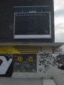
File:SBF Workshop10.jpg|Advertising | |||
File:SBF Workshop09.jpg|GPS logger | |||
File:SBF Workshop06.jpg|Florian Tower | |||
File:SBF Workshop01.jpg|View from tower | |||
File:SBF Workshop08.jpg|View from tower | |||
File:SBF Workshop07.jpg|Phoenixhalle from TV-tower | |||
File:SBF Workshop12.jpg|Sniffing sounds | |||
File:SBF Workshop11.jpg|View from tower | |||
File:SBF Workshop17.jpg|View from tower | |||
</gallery> | |||
[[File:SBF Workshop13.jpg|570px]] | |||
* More [http://picasaweb.google.com/gabriel.menotti/SatelliteBorderFootprint pictures] of the walk to the Florian tower and of the presentations by Gabriel | |||
[[Category:Linklist]] | |||
[[Category:GPS]] | |||
[[Category:Satellite]] | |||
Latest revision as of 09:59, 14 October 2010
Space to share information, links etc. for the Satellite/Border/Footprint Workshop by Lisa Parks at the HMKV, organized by Francis Hunger

Participants
- Lena Brüggemann (D)
- Büro für Unabwägbarkeiten (D) David Hahlbrock, Franziska Windisch, Anselm Bauer
- Francis Hunger, (D)
- Frank Hoppe (D)
- Elena Marcevska (UK/MAC)
- Gabriel Menotti (UK/BR)
- Max Neupert (D)
- Lisa Parks, (US) University of California, Santa Barbara
- SnowKrash (D) Ursel Quint & Barry L. Roshto
- Tatjana Vukelic (SER)
Workshop
- Home is Where you get a Signal A two hour sketch output by the “Büro für Unabwägbarkeiten” and Gabriel Menotti
- Mapping micro crash-course on GPS-cartography by Max Neupert. Get the File:Excursion to Dortmund TV Tower.gpx to import this in Google Earth or view in Open Street Map.
- How can I Transmit via Satellite? - some thoughts on a question that appeared during the workshop
- How to spot Iridium satellites with bare eyes - internet based weather and satellite prediction combined with three dimensional orientation in physical space
- Traces of satellite-use in the city - a walk through Dortmund Nordstadt. Elena Marcevska and Lena Brüggemann
- Satellites and Aviation - sensing around Dortmund Airport - Ursel Quint - Frank Hoppe
Satellite information
- Space Is The Place A class by Max Neupert in the winter semester 2009
- Space linklist a list of space related links, artists, astronomy and satellite tracking
- Weather resources, forecasts, cloud satellite images and rain maps, not only for astronomy.
- GPS mapping websites, cartography and GPS artworks
- Suppliers#Electric and electronic parts consult this page if you want to buy electronics like GPS receivers/loggers
- lyngsat.com great resource about all satellites and their footprints
- satbeams.com
- Michael Paulkner Infographic: satellites and their owners
- vizworld collection of graphic visualizations about satellite technology
- Satellites: A user manual Beautiful infomercials by agency ThisIsRealArt for Astra-SES.
- www.satsignal.net Huge collection of information about satellites and signals. Codes, decoding, software, mapping. Some of the software is commercial.
Representation from orbital perspective
- Powers of Ten, Charles and Ray Eames wikipedia:Powers of ten. Other earth Zooms.
- GMU:Works#Bernhard Hopfengärtner: HELLO WORLD!
- Dead pixel in Google Earth, Helmut Smits
- wikipedia:Leylines, wikipedia:Nazca lines wikipedia:crop circles
- www.diydrones.com Resources for DIY Drones (Autonomous Robotic Vehicles) which can carry scan devices (e.g. cameras)
- Grassroots Mapping, forms of not-so-remote sensing and low-tech mapmaking
Satellite dishes

- Satellite free-to-air DIY kit
- How to Reverse-Engineer a Satellite TV Smart Card
- The Max Headroom Incident (don't know where this should go)
- The Itty Bitty Radio Telescope a DIY Radio Telescope made of a satellite dish
Satellite tracking
See Satellite tracking.
Balloon Information
- 1337arts.com Project Ikarus – low cost near space remote technology
- University of Wyoming’s balloon trajectory website Predict your balloon flight in google earth related to your geo-coordinates
- telegraph.co.uk Article in the online edition of newspaper The Telegraph (UK): Teens capture images of space with 56 pounds camera and a balloon
- Hobbyspace.com Near Space exploring with balloons on hobbyspace.com – a resource for amateur space action
- Away 5 – Advanced Balloon Platform
Artworks and artists
See Space Art for a list of artists who deal with satellites and/or outer space in their practice. A compilation of artists and literature about locative artworks is filed as GPS.
Books, readers
- Material listing
- von Borries, Friedrich; Böttger, Matthias; Heilmeyer, Florian: TV Towers – 8,559 Meters Politics and Architecture ISBN 3868590242
- Günther, Ingo: REPUBLIK.COM ISBN 3893229485
- McCray, W. Patrick: Keep Watching the Skies, ISBN 0691128545
- Paglen, Trevor: Blank Spots On The Map – The Dark Goegraphy Of The Pentagon's Secret World ISBN 9780525951018
- Paglen, Trevor: I Could Tell You But Then You Would Have To Be Destroyed By Me - Emblems From The Pentagon's Black World ISBN 9781933633329
- Parks, Lisa: Cultures in Orbit – Satellites and the Televisual ISBN 978-0822334972
- Redfield, Peter: Space in the Tropics: From Convicts to Rockets in French Guiana ISBN 0520219856
- Virilio, Paul: Open Sky, Verso, 1997, ISBN 1859841813
- Virilio, Paul: Big Optics (scribd link)
- Weibel, Peter (publisher): Ocean Earth: 1980 bis heute ISBN 3927789720
Media
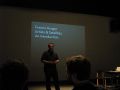
Lecture Francis
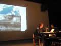
Presentation Büro
David
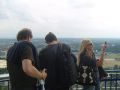
Lecture Lisa
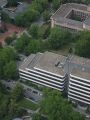
Concrete in daylight
Concrete at sunset
Essen in Dortmund
Advertising
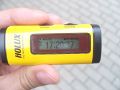
GPS logger
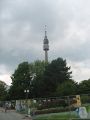
Florian Tower
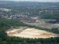
View from tower
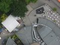
View from tower
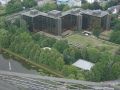
Phoenixhalle from TV-tower
Sniffing sounds
View from tower
View from tower


- More pictures of the walk to the Florian tower and of the presentations by Gabriel