The recultivation of Potash mining Dumps
Project Idea:
Excursion
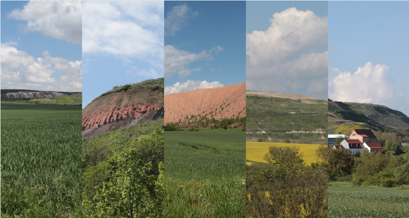
To get a better overview of the potash mining dumps as well as a better understanding of their scale and position in the surrounding landscape I visited five these mining dumps in the north of Thuringia. With the help of my boyfriend, I documented the locations we visited, starting in Roßleben, going to Bleicherode, then to Bischofferode, Sollstedt and lastly to Menteroda.
From far away most of the dumps seemed fairly inconspicuous because of how far they were into their recultivation process. For the untrained eye they looked like regular mountains but coming closer you would realize that the shape of the mountains looked to manmade to be natural. The slopes often enough reveal the actual material of the dumps, that the plant life tries to cover up. The color the potash varies between a dirty white and a light reddish-brown. Colors that are natural but are rarely seen by us humans because of how deep the actual material lies in the ground. The potash is a natural material but seeing a gigantic white or reddish-brown mountain somewhere in the fields, we know for a fact is unnatural. Placed there by people and this is just undermined by the industrial structures build surrounding the dump. A fence keeping out interested onlookers. Now it is rectified to hold of people from exploring the potash mining dumps. They could get hurt and it is still private owned land but what will happen when the mining dump isn’t a mining dump anymore. What if it has become a recultivated hill? It has become a part of nature again so does it still make sense to hold of people from wandering on it like they would walk on a normal mountain? This is just a thought that popped up in my head while my excursion.
I created a presentation that shows of the locations I visited and some pictures I made:
